What are floods?
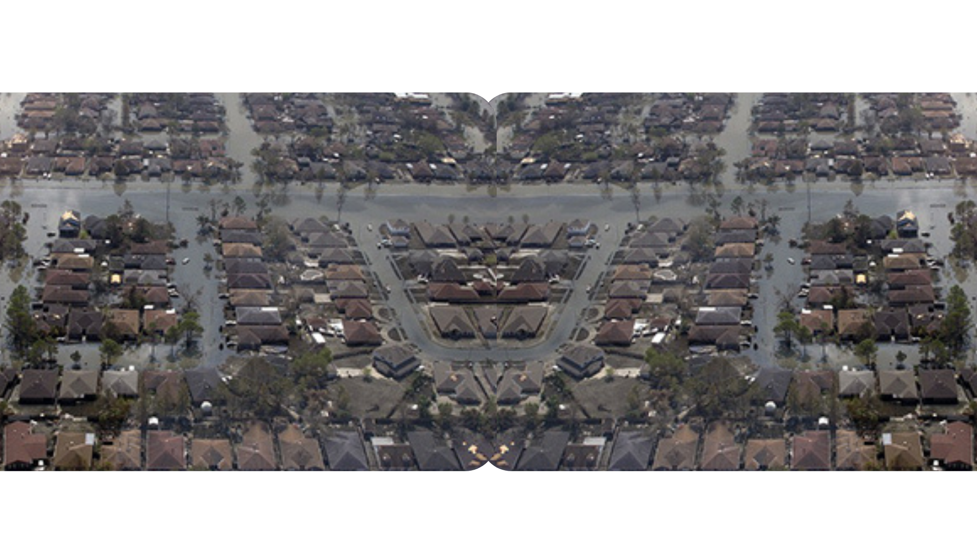
Floods are among the most frequent and costly natural disasters. They range from a few inches of water to several feet deep and can come in quickly or build gradually. In Texas, conditions that cause floods include heavy rains that saturate the ground and storm surges. Flash flooding occurs suddenly due to rapidly rising water along a stream or low-lying area, leaving little time for affected residents to evacuate their home or business, or their car if attempting to drive across a flooded roadway. Because flash floods can be sudden, roadways can be covered in swiftly moving floodwater, making them unsafe and impassable. Did you know that in certain flooding conditions, a vehicle can be washed away in less than 12 inches of fast-moving floodwater? Most flood-related deaths are due to motorists attempting to cross a flooded low-water crossing or road. Know your flood risk, and ‘Turn Around, Don’t Drown®”!
_______
DETERMINING THE RISK

FEMA conducts a Flood Insurance Study to identify a community’s flood risk. Flood hazard maps outlining the community’s different flood risk areas are created using statistical data for river flow, storm tides, hydrologic/hydraulic analyses, and rainfall and topographic surveys.
CLICK HERE to hear how FEMA's Flood Insurance Advocate explains flood risk.
UNDERSTANDING YOUR AREA
In the Corpus Christi area, you will find the Gulf of Mexico, several large bays, rivers, and creeks. Corpus Christi Bay has two main extensions, Nueces Bay which extends to the Nueces River, and Oso Bay which extends to Oso Creek. La Volla Creek watershed is another tributary to Oso Creek. Together with extensions, the Corpus Christi Bay forms one of the seven major estuaries along the Gulf Coast of Texas. Laguna Madre, the second largest of the Texas estuaries, is a long, shallow, hypersaline lagoon along Padre Island.
Approximately 16% of the total City area lies within the Special Flood Hazard Area (SFHA) on FEMA flood maps. Corpus Christi is no stranger to rain and floods. Our climate and coastal location make us susceptible to flooding, especially during extreme weather events. For example, in 2020, Hanna unleashed more than 15 inches of rain in parts of South Texas, resulting in serious flash flooding which caused extensive damage. It is important to note that even smaller storms can result in flooding, endangering people and property.
For information on past major South Texas weather events visit: Major South Texas Storm Events (weather.gov)
CLICK HERE to learn more about food risk.
FLOOD HAZARD AREAS

What exactly is a 100-year flood?
The phrase “100-year flood” has caused much confusion over the years. Many believe that it is a flood that occurs every 100 years. However, the phrase really means a flood that has a 1% chance of occurring in any given year. Statistically speaking, over a 30-year period, a 100-year flood has a 26% chance of occurring. A 500-year flood has a 0.2% chance of happening in any given year and a 6% chance in any 30-year period. The risk of flooding also increases as you move closer to the stream centerline and deeper into a 100+year floodplain, as shown below. This is because the susceptibility to flooding from more frequent events such as the 25-year flood increases as you get closer to the flooding source.
CLICK HERE to learn more about flood zones.
Zone A
- Fill is allowed.
- Garage can be located below BFE if properly vented
Zone V
- Fill is prohibited
- Structures must be elevated using piers, pilings or columns
- Areas below BFE must be used solely for parking, access or storage and must be constructed with breakaway walls
- A V Zone Design Certificate must be submitted prior to permit issuance. The certificate must be certified by a registered professional engineer or architect that the design and planned methods of construction meet NFIP requirements.
-
A non-conversion agreement* must be submitted after building final and before Certificate of Occupancy is issued for new construction, including additions, permits with or without a proposed enclosure.
*A non-conversion agreement for new construction, including additions, with or without an enclosure below base flood elevation is an agreement that the enclosed space will not be converted to a habitable living space. The area must remain solely used for parking, access or storage.

- First Street's - Flood Factor allows you to see your potential flood risk. This map is created by the nonprofit First Street Foundation. While this is a helpful tool, it is not used for determining flood insurance requirements and should be used in conjunction with the FEMA National Flood Hazard Layer.
- TexasFLOOD is a website that works in collaboration with the Texas Water Development Board (TWDB), Texas Department of Emergency Management (TDEM), and the Texas General Land Office (GLO) to provide a jumping off point for Texans who need more information, resources, and support regarding flood awareness and preparedness.